ข้อมูลการปฏิบัติที่ดีที่สุด (Best Practice) ของกรุงมอสโก สหพันธรัฐรัสเซีย
ระบบป้ายนำทางการขนส่งที่เป็นแบบเดียวกันของกรุงมอสโก
กรุงมอสโกมีระบบป้ายบอกทางที่เป็นแบบเดียวกันรูปแบบใหม่ที่รวมการขนส่งทุกรูปแบบของเมืองเข้าด้วยกัน ซึ่งช่วยให้ประชาชนและนักท่องเที่ยวระบุตำแหน่งและวางแผนเส้นทางได้ดีที่สุดบนแผนที่ซึ่งมีข้อมูลสอดคล้องกัน
เหตุใดจึงจำเป็นต้องมีระบบป้ายนำทางที่เป็นแบบเดียวกัน
มหานครขนาดใหญ่ที่ทันสมัยจะปราศจากระบบการนำทางที่เป็นมิตรต่อผู้ใช้ไม่ได้ ระบบดังกล่าว
ไม่เพียงแต่ประกอบด้วยเครื่องหมายและลูกศรเท่านั้น แต่ยังรวมถึงวิธีการทั้งหมดที่ประชาชนใช้เพื่อการกำหนดตำแหน่งและทิศทาง ระบบนำทางรูปแบบใหม่ได้รวมเอารูปแบบการขนส่งทั้งหมดให้เป็นเครือข่ายแบบหนึ่งเดียวโดยการนำเสนอข้อมูลที่ชัดเจนและเข้าใจได้ง่ายในลักษณะถูกที่ถูกเวลาตลอดเส้นทางการเดินทาง
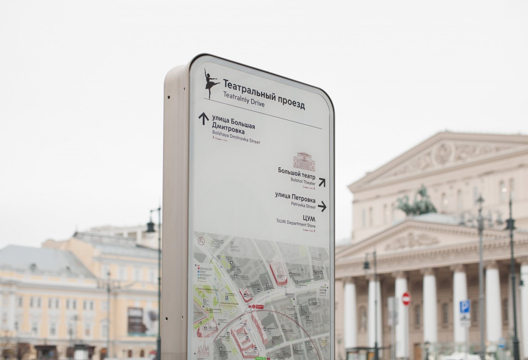
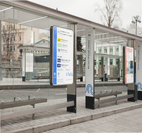

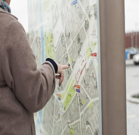
ระบบป้ายรูปแบบเดิมมิได้นำเสนอข้อมูลการขนส่งของเมืองให้เป็นระบบเดียวกัน และทำให้นักท่องเที่ยวเข้าใจข้อมูลได้ยาก
ในสถานีรถไฟใต้ดิน นักท่องเที่ยวพบปัญหาในการหาทางออกที่ต้องการ และคนเดินเท้าต้องใช้เวลาเพิ่มขึ้นเพื่อศึกษาเส้นทางรอบเมือง
เพื่อแก้ไขปัญหาเหล่านี้ เราได้วิเคราะห์ว่าผู้คนมีประสบการณ์ในการเดินทางไปมาในเมืองอย่างไรรวมถึงปัญหาและคำถามที่สำคัญ ๆ ของพวกเขาเหล่านั้น
ความต้องการที่แท้จริงของประชาชนอยู่ที่แนวคิดเกี่ยวกับระบบป้ายนำทางของเมืองที่เป็นแบบเดียวกัน โดยระบบใหม่นี้จะอยู่บนพื้นฐานของการใช้เครื่องมือชุดเดียว ซึ่งทำให้สามารถเข้าใจเครือข่ายการขนส่งได้ง่ายและเป็นมิตรต่อผู้ใช้งาน
ระบบป้ายนำทางขนส่งรูปแบบใหม่นี้ทำให้สามารถเข้าใจเครือข่ายการขนส่งได้ง่ายขึ้นและเป็นมิตรต่อผู้ใช้งาน
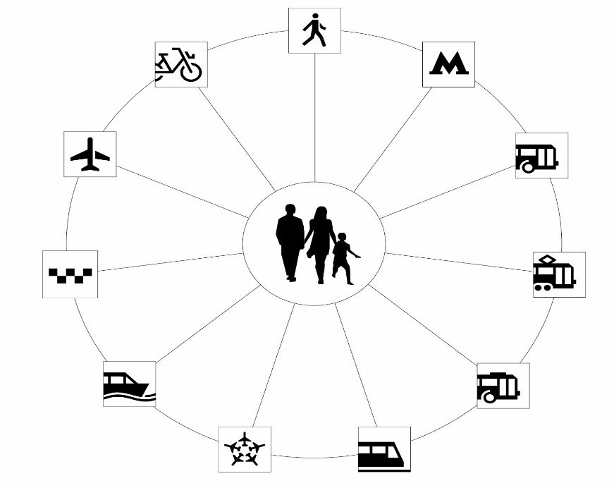
ระบบการนำทางทำงานอย่างไร
การเชื่อมต่อเส้นทาง
ระบบนี้มุ่งเน้นไปที่รถไฟใต้ดิน การขนส่งภาคพื้น พื้นที่คนเดินเท้า เครือข่ายการแบ่งปันจักรยานของเมือง และศูนย์กลางการเชื่อมต่อการเดินทาง และระบบดังกล่าวยังช่วยกำหนดตำแหน่งตามเส้นทางทั้งบนดินและใต้ดิน องค์ประกอบแต่ละอย่างถูกออกแบบมาสำหรับพื้นที่เฉพาะ ซึ่งช่วยวางแผนการเดินทางได้

แผนที่
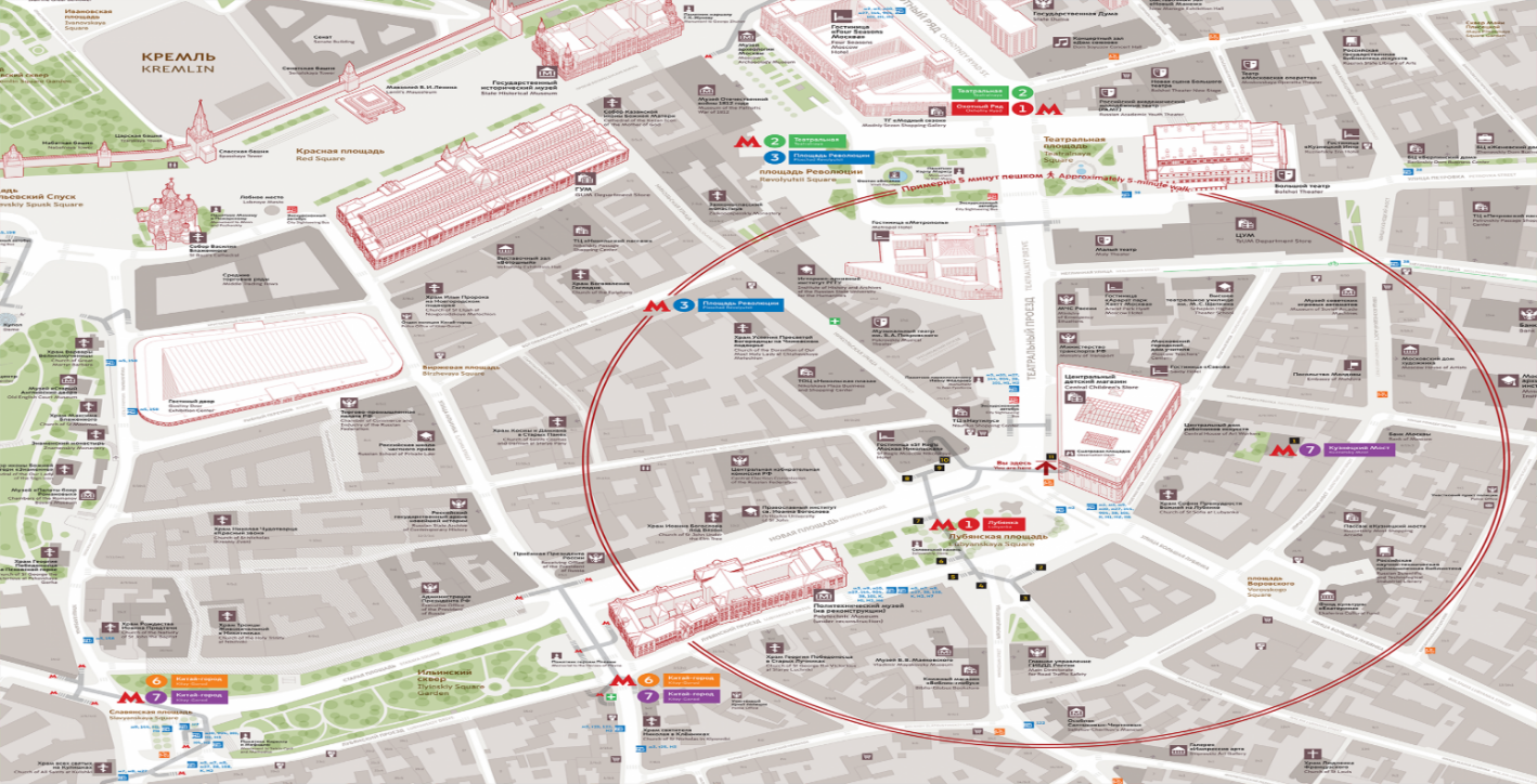
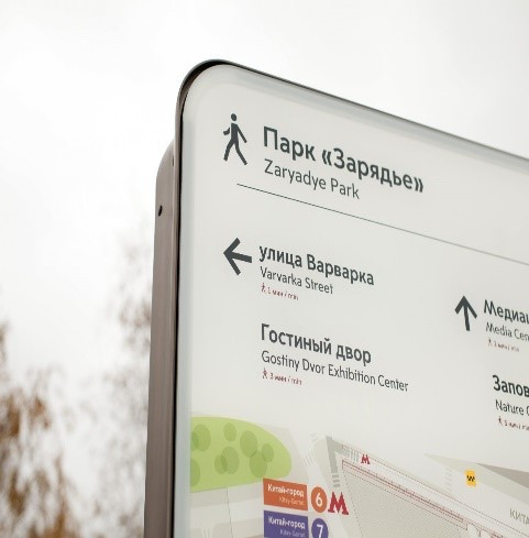
แผนที่เมืองสำหรับคนเดินถนนได้ปรากฏขึ้นเป็นครั้งแรกในกรุงมอสโก ซึ่งทั้งหมดได้ถูกออกแบบโดยคำนึงถึงตำแหน่งที่อยู่ของบุคคล โดยมีการระบุว่า “คุณอยู่ที่นี่” แผนที่เหล่านี้ถูกทำให้มุ่งเน้นไปที่ผู้ใช้อย่างแท้จริง แม้กระทั่งสิ่งที่อยู่ด้านขวาก็อยู่ด้านขวาของผู้ที่กำลังมองไปที่แผนที่ด้วยผู้ที่คุ้นเคยกับทิศทางหลักสำหรับการกำหนดตำแหน่งจะสังเกตเห็นลูกศรที่ชี้ไปทางทิศเหนือ แผนที่เหล่านี้มีวงกลมซึ่งระบุระยะทางที่ใช้เวลาเดินห้านาทีจากตำแหน่งของผู้ที่กำลังดูแผนที่อยู่
หมายเลขบริเวณทางออกของสถานีรถไฟฟ้า
ปัจจุบัน บริเวณทางออกของสถานีรถไฟมีการระบุหมายเลขทางออกตามเข็มนาฬิกา ซึ่งช่วยให้ประชาชนหาทิศทางได้อย่างถูกต้อง ศูนย์กลางการเชื่อมต่อที่สำคัญหลายแห่งซึ่งประกอบด้วยสถานีต่าง ๆ (สถานีห้าง
โอโคตนึย เรียด - สถานีเทียทรัลนายา - สถานีจัตุรัสเรโวลูซี) มีหมายเลขเรียงกันตามลำดับ นอกจากนี้ ทางออกได้ถูกปรับเปลี่ยนให้เหมาะสำหรับผู้โดยสารที่เคลื่อนไหวไม่สะดวกจะทำสัญลักษณ์ด้วยเครื่องหมายทางลาดและลิฟต์
ดัชนีป้ายหยุดรถประจำทาง
ป้ายหยุดรถประจำทาง ณ ศูนย์กลางการเชื่อมต่อหลักจะมีดัชนีระบุไว้เพื่อให้ประชาชนสามารถค้นหาป้ายหยุดรถประจำทางที่ต้องการในแผนที่และในเมืองได้โดยง่าย

ชื่อที่มีการทับศัพท์
ชื่อเฉพาะในระบบนำทางจะถูกระบุซ้ำเป็นภาษาอังกฤษ

สถานที่สำคัญ
สถานที่สำคัญของเมืองที่ช่วยระบุตำแหน่งของผู้ที่มาเยือนจะมีการระบุเป็นรูปและเครื่องหมาย เพื่อสร้างความคุ้นเคยแก่ผู้มาเยือน ซึ่งจะช่วยให้ประชาชนเข้าใจความหมายได้เร็วขึ้นและหาทิศทางที่ต้องการได้ สถานที่สำคัญระบุไว้ในระบบนำทางและถือเป็นจุดอ้างอิงเพิ่มเติม

การออกแบบเชิงอุตสาหกรรม
มีการพัฒนารูปแบบพิเศษเพื่อการออกแบบโครงสร้างที่ใช้ในระบบป้ายแบบใหม่ วัสดุที่ใช้ผลิตจะคัดเลือกอย่างพิถีพิถันเพื่อให้กระทบต่อสิ่งปลูกสร้างภายในเมืองน้อยที่สุด และไม่จำเป็นต้องทาสีเพื่อให้คงสภาพของป้ายไว้ การออกแบบภายนอกได้รับแรงบันดาลใจจากสถาปัตยกรรมภายในกรุงมอสโก
 ระบบมีการพัฒนาอย่างไร
การพัฒนาระบบป้ายนำทางขนส่งที่เป็นหนึ่งเดียวเริ่มต้นในปี ค.ศ. ๒๐๑๓ และมีความพร้อมภายในหนึ่งปี มีการเริ่มต้นโครงการนำร่องกับรถไฟใต้ดิน โดยมีป้ายสัญญาณข้อมูลพร้อมแผนที่สำหรับคนเดินถนนและหมายเลขทางออก ณ สถานีรถใต้ดินจำนวนห้าสถานี
พร้อมกันนั้นแผนที่เพื่อการเข้าถึงระบบก็มีให้บริการ ณ สถานีบริการแบ่งปันจักรยาน
ป้ายหยุดรถประจำทางแห่งแรกที่มีป้ายบอกทางแบบใหม่นี้แล้วเสร็จในปี ค.ศ. ๒๐๑๕ โดยป้ายพร้อมแผนที่เมืองสำหรับคนเดินเท้ายังเริ่มต้นในช่วงเวลาดังกล่าวด้วย
ระบบการนำทางรูปแบบใหม่เริ่มต้นใช้อย่างกว้างขวางตั้งแต่ปี ค.ศ. ๒๐๑๖ โดยมีการติดตั้งข้อมูลสำหรับผู้โดยสารบริเวณสถานีรถไฟใต้ดิน ป้ายรถประจำทาง ตลอดจนถนนคนเดินต่าง ๆ
ข้อมูลอ้างอิง
ผู้โดยสารกว่า ๕๐๐,๐๐๐ คนใช้บริการรถประจำทางมากิสทรัลเป็นประจำทุกวัน
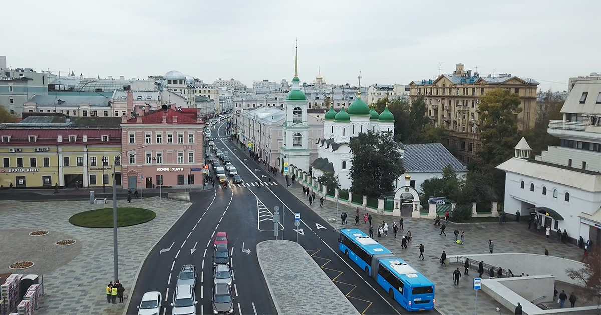
เมื่อเครือข่ายรถประจำทางมากิสทรัลในพื้นที่ใจกลางเมืองเริ่มให้บริการ จึงมีการปรับปรุงป้ายนำทางการขนส่งภาคพื้นด้วย แผนที่เหล่านี้ระบุชนิดของเส้นทางด้วยรหัสสี ป้ายนำทางรูปแบบใหม่นี้เริ่มให้บริการบริเวณศูนย์กลางการเชื่อมต่อการเดินทางตั้งแต่ปี ค.ศ. ๒๐๑๗ แผนที่ดังกล่าวหาได้ตามศูนย์กลางการเชื่อมต่อการเดินทางขนาดใหญ่ เช่น จัตุรัสสลาเวียนสกายา
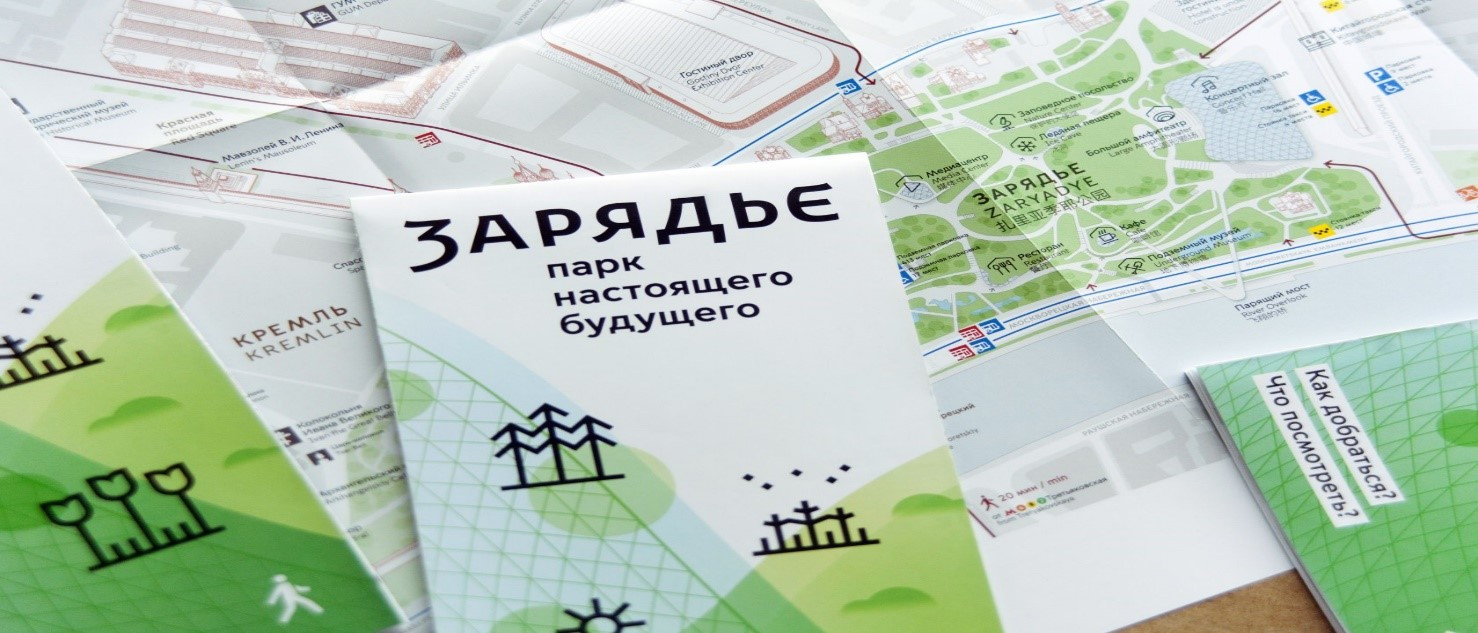
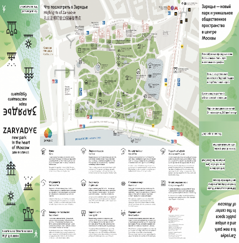
หนังสือพับเล่มเล็ก (Booklet) เกี่ยวกับสวนสาธารณะซาเรียเดียเป็นแผนที่แบบพิมพ์เล่มแรกที่ผลิตขึ้นโดยมีรูปแบบเดียวกันกับระบบกราฟิกของเมือง
หนังสือพับเล่มเล็กดังกล่าวมีข้อมูลเส้นทางการเดินทางที่สะดวกมายังสวนสาธารณะ และมีแผนที่ของพื้นที่สีเขียวและถนนที่อยู่ติดกันแหล่งใหม่ โดยสามารถรับได้ที่สถานีรถไฟใต้ดินและที่สวนสาธารณะซาเรียเดีย
ระบบป้ายนำทางการขนส่งจะเสร็จสมบูรณ์เมื่อมีการติดตั้งองค์ประกอบต่าง ๆ ในทุกพื้นที่ด้านการขนส่งและทรัพย์สินของเมือง และเนื่องจากระบบใหม่ดังกล่าวอยู่ระหว่างการเปิดตัวอย่างค่อยเป็นค่อยไป ในขณะนี้ข้อมูลยังมีไม่ครบทั้งหมด
ข้อมูลอ้างอิง
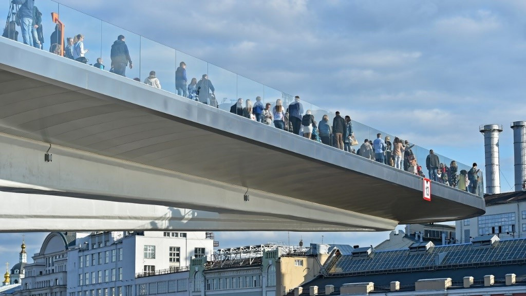
พิพิธภัณฑ์ใต้ดิน ถ้ำน้ำแข็งและเครื่องย้อนเวลา: สิ่งที่ห้ามพลาด ณ สวนสาธารณะซาเรียเดีย
มีการให้บริการระบบใหม่นี้อย่างไร
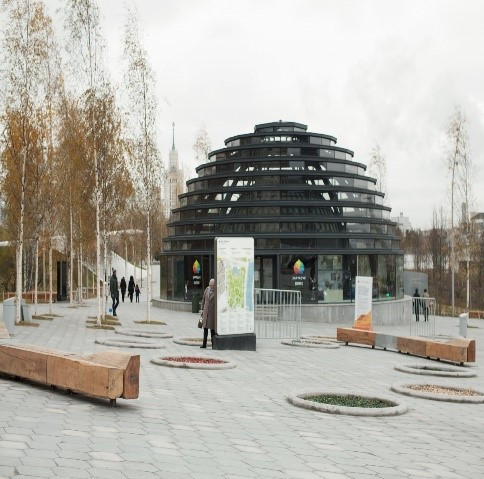
มีการติดตั้งป้ายรูปแบบใหม่นี้บริเวณที่ผู้โดยสารและคนเดินถนนจำเป็นต้องตัดสินใจว่าจะเลือกเดินทาง
ไปต่ออย่างไร การออกแบบต้องมีการวิเคราะห์รูปแบบของการเดินทางเท้าของคนเดินถนน การพิจารณาบริบท
และลักษณะเฉพาะในแต่ละสถานที่และรายการคำถามเพื่อที่ผู้ใช้จะได้รับคำตอบ ณ จุดดังกล่าวภายในเมือง
นักออกแบบได้ใช้ประสบการณ์ที่ได้รับจากเมืองต่าง ๆ ของโลก ที่ซึ่งมีการใช้ป้ายนำทางอย่างประสบความสำเร็จมากที่สุด นักพัฒนาวิเคราะห์วิธีการนำทางที่ล้ำสมัยตลอดเวลาเพื่อหาแนวทางแก้ไขปัญหาที่ดีที่สุดสำหรับกรุงมอสโก
การรับเอาการนำทางมาใช้ต้องมีการทดสอบและทบทวนอยู่เสมอ มิใช่ว่ารูปแบบต่าง ๆ ที่มีใช้ในโลกจะเหมาะสมกับกรุงมอสโก ตัวอย่างเช่น แนวทางปฏิบัติของกรุงลอนดอนในการใช้ทิศทางหลักสำหรับการกำหนดตำแหน่งก็ไม่ได้หยั่งรากลึกในกรุงมอสโก ซึ่งผู้โดยสารสับสนกับลูกศรที่ชี้ไปทาง “เหนือ” และ “ใต้” และการใช้ชื่อเรียกสถานีปลายทางได้ถูกนำมาใช้ใหม่ แม้ว่าเดิมทีความคิดนี้ได้ถูกยกเลิกไปแล้วก็ตาม
ผู้ที่ปฏิบัติงานในโครงการนี้คือใคร
สำนักการขนส่งและการพัฒนาโครงสร้างพื้นฐานทางถนนกรุงมอสโกกำลังพัฒนาระบบป้ายนำทางการขนส่งให้เป็นรูปแบบเดียวกัน โดยคณะทำงานประกอบด้วย นักออกแบบด้านกราฟิกและอุตสาหกรรม นักเขียนแผนที่ นักวิเคราะห์ บรรณาธิการและผู้จัดการ ซึ่งคณะทำงานมีทั้งชาวรัสเซียตลอดจนผู้เชี่ยวชาญระดับโลกปฏิบัติงาน
ในโครงการนี้อย่างต่อเนื่อง
หากมีข้อสงสัย
หากมีคำถาม สามารถติดต่อได้ที่: wayfinding@transport.mos.ru
ประชาชนสามารถแจ้งกรุงมอสโกได้ในกรณีที่การนำทางมีข้อผิดพลาด เป็นจดหมายได้ที่: wayfinding@transport.mos.ru.
ทั้งนี้ ประชาชนทุกคนสามารถส่งข้อเสนอแนะเกี่ยวกับการปรับปรุงป้ายบอกทางของเมืองมายังที่อยู่ไปรษณีย์อิเล็กทรอนิกส์เดียวกันข้างต้น
Uniform Transport Navigation Signage System in Moscow
Moscow has a new, consistent directional signage system that includes all types of city transport. It allows residents and tourists to identify their location and plan the best routing on consistent maps.
Why is a uniform navigation signage system needed?
A modern mega city cannot do without a user-friendly navigation system. This includes not only signs and arrows, but also all the methods used by people for orientation and direction. The new navigation system puts all types of transport into a uniform network by offering clear and understandable information at the right time and in the right place along a route.


The previous signage system did not present city transport as one system and it was hard to understand for tourists.
In the metro tourists found it difficult to find the exit they needed, and it took pedestrians some time to learn their way around the city.
To resolve these problems, we analyzed how people experienced getting around in the city, their main problems and questions.
Real people's needs underlie the concept of a uniform city navigation signage system. The new system is based on a single toolset, which makes the transport network understandable and user-friendly.
The new system makes the transport network understandable and user-friendly

How does the navigation system work?
Route connectivity
The system is intended for the metro, surface transport, pedestrian spaces, the city's bike-share network, and transit hubs, and it facilitates orientation along the way on the ground and underground. Each component is designed for a specific place, where it helps plan a route.

Maps
City maps for pedestrians have appeared in Moscow for the first time. All of them are designed with due account of the person's location. It is marked "You are here." The maps are oriented so that everything on the right is also to the right of the person looking at the map. Those accustomed to cardinal directions for orientation will see an arrow pointing to the north. The maps have circles indicating a five-minute walk from their location.

Metro exit numbers
Metro exits are now numbered clockwise. This helps people find the right direction. Major interchange hubs comprising several stations (Okhotny Ryad — Teatralnaya — Ploshchad Revolyutsii) have consecutive numbering. In addition, exits adapted for passengers with impaired mobility are marked with ramp and lift icons.
Stop indexes
Major transit hub stops are indexed so that people can easily find the stop they need on the map and in the city.

Transliterated names
Proper names in the navigation system are duplicated in English.

Landmarks
City landmarks that help orient visitors are marked with images and icons. This helps people identify them quicker and find the desired direction. Landmarks are indicated in the navigation system and serve as additional reference points.

Industrial design
A special style has been developed for the design of structures used in the new signage system. Materials were selected to minimise vandalism and that do not require painting to maintain their appearance. The exterior design was inspired by Moscow architecture.

How was the system developed?
The development of a single transport navigation signage system began in 2013 and was ready within a year. The pilot project was launched in the metro: information signs with pedestrian maps and exit numbers appeared at five stations.
At the same time maps for system accessibility appeared at the bike-share stations.
The first bus stop with the new signage was completed in Moscow in 2015. Signage with city maps for pedestrians also began appearing at that time.
The new navigation system began to be used on a wide scale since 2016. Information for the passengers is placed in the metro and at the stops as well as on pedestrian streets.

Reference materials
Over 500,000 riders use Magistral buses every day
When the Magistral bus network was introduced in the city centre, surface transit navigation signage was revised. The maps now specify the type of route with a colour code. The new navigation signage has been introduced at transit hubs since 2017. Such maps are already available at larger hubs like Slavyanskaya Ploshchad.
A booklet for Zaryadye Park was the first printed map made in the same style as the city's graphic system.
It contains the preferable transit routes to the park and maps of the new green area and adjacent streets. The booklets were on hand at metro stations and in Zaryadye Park.
The single navigation signage system will be complete when the components have been installed at all transport and city properties. Since the new system is being introduced gradually, not all the information is available so far.

Reference materials
Underground museum, ice cave and Time Machine: Must-see in Zaryadye


How is the new system put into service?
The new signage is placed where passengers and pedestrians need to decide their next step. The design requires analysis of pedestrian patterns, consideration for the context and specific features of each location and a list of questions for which the user can get an answer at this point in the city.
The designers used the experience of other world cities where navigation signage works most successfully. The developers permanently analyze advanced navigation methods to find the best solutions for Moscow.
Adoption of navigation always includes testing and review. Not all of the designs established in world practice are good enough for Moscow. For example, London's practice of using cardinal directions for orientation did not take root in Moscow. Passengers were confused by the "North" and "South" arrows and the use of the names of terminal stations was reintroduced, although initially the idea was to discard them.
Who is working on the project?
The Moscow Department for Transport and Road Infrastructure Development is developing the uniform transport navigation signage system. The team comprises graphic and industrial designers, cartographers, analysts, editors and managers. Russian as well as world experts are constantly working on the project.
Any questions?
Point of contact for questions: wayfinding@transport.mos.ru
Residents can notify the city of any navigation errors by writing to: wayfinding@transport.mos.ru.
Anyone can send proposals on city signage improvement to the same address.
Source: https://www.mos.ru/en/city/projects/design/
เอกสารแนบ : Best Practice - กรุงมอสโก Uniform Transport Navigation Signage System (พงศ์นรินทร์) (หนก.ตรวจแล้ว).pdf